 |
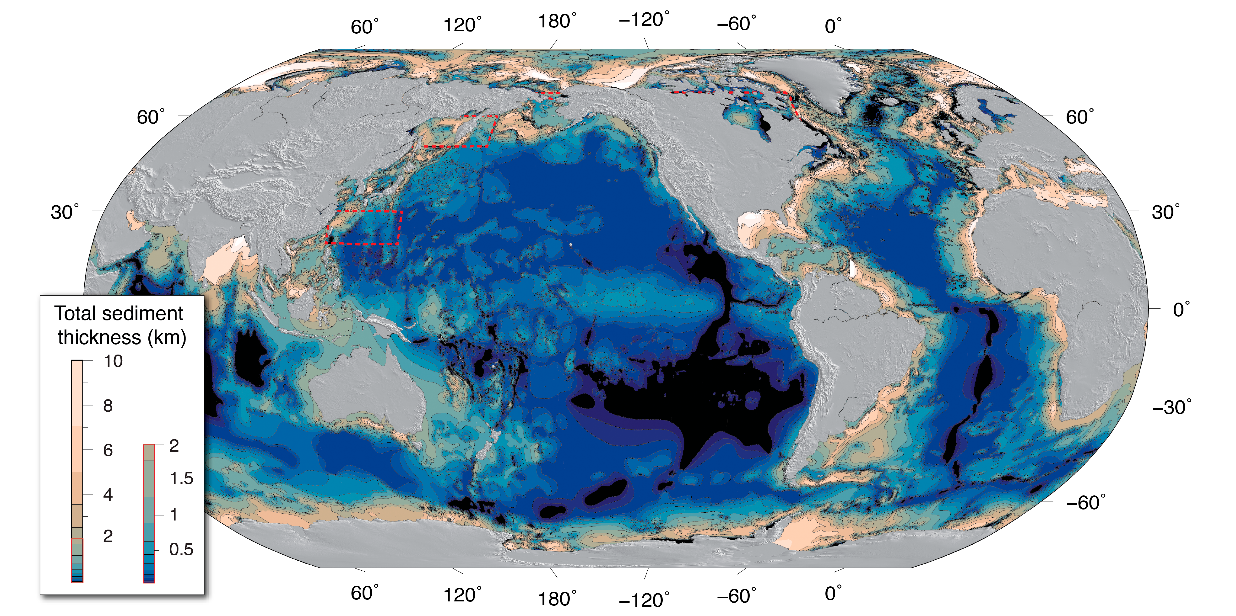
NCEI's global ocean sediment thickness grid of Divins (2003) updated by Whittaker
et al. (2013) has been updated again for the NE Atlantic, Arctic, Southern Ocean,
and Mediterranean regions. The new global 5?arc?minute total sediment thickness grid,
GlobSed, incorporates new data and several regional oceanic sediment thickness maps,
which have been compiled and published for the, (1) NE Atlantic (Funck et al., 2017;
Hopper et al., 2014), (2) Mediterranean (Molinari and Morelli, 2011), (3) Arctic (Petrov
et al., 2016), (4) Weddell Sea (Huang et al., 2014), and (5) the Ross Sea, Amundsen
Sea, and Bellingshausen Sea sectors off West Antarctica (Lindeque et al., 2016; Wobbe
et al., 2014). This version also includes updates in the White Sea region based on
the VSEGEI map of Orlov and Fedorov (2001). |