Archive of Geosample Data and Information from the University of Texas at Austin (UT) Institute of Geophysics

browse graphic
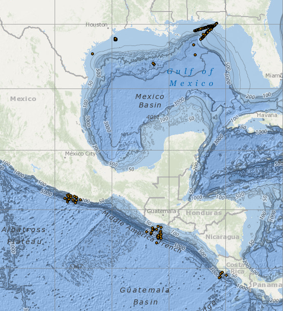
image of sea floor sample locations
Metadata describing piston cores curated by Institute of Geophysics of the University of Texas at Austin (UT) collected from 1976 to 1978 were coded and contributed by UT to the Index to Marine and Lacustrine Geological Samples (IMLGS) database. Descriptions are for 204 piston cores collected in the Gulf of Mexico, during 390 cruises of the Gus III, the Longhorn, and the Ida Green. These samples are no longer available for distribution/study, but are well described in the IMLGS.
  • Cite as: University of Texas at Austin (UT) Institute of Geophysics. 1977: Archive of Geosample Data and Information from the University of Texas at Austin (UT) Institute of Geophysics. NOAA National Centers for Environmental Information. https://doi.org/10.7289/V5513W54. Accessed [date].
  • doi:10.7289/V5513W54
  • NCEI Metadata ID: gov.noaa.ngdc.mgg.geology:archived-data_UT-sample-repository
gov.noaa.ngdc.mgg.geology:archived-data_UT-sample-repository
Search Data
  • Map viewer (search)
    Open an ArcGIS interactive map interface with the UT sample layer active, to search and download data from the IMLGS database and access related links. Switch to the Arctic map for better viewing.
  • Linked data interface (search)
    Offsite Linked Data interface (RDF graph) for Semantic Web access to the database, offered cooperatively on the Rolling Deck to Repository (R2R) server.
  • Open Data ArcGIS interface (search)
    Access sample information from the IMLGS using the Open Data ArcGIS interface enabling filtering, sorting, and export in multiple formats
Download Data
  • Web forms interface (download)
    Text interface to search and download data for UT samples from the IMLGS database and access related links.
Distribution Formats
  • ASCII (Version:UTF-8)
    • File Specification: American Standard Code for Information Interchange (ASCII) text format.
  • KML
    • File Specification: Keyhole Markup Language File
Ordering Instructions Contact NCEI for other distribution options and instructions.
Distributor NOAA National Centers for Environmental Information
ncei.info@noaa.gov
Dataset Point of Contact NOAA National Centers for Environmental Information
ncei.info@noaa.gov
Dataset Point of Contact Marine Geology Data Manager
NOAA National Centers for Environmental Information
geology.info@noaa.gov
Coverage Description Global ocean sea floor and lakebeds
Time Period 1976-06-11T00:00:00.000Z to 1978-07-13T00:00:00.000Z
Spatial Reference System urn:ogc:def:crs:EPSG:4326
Spatial Bounding Box Coordinates
West:-99.127
East:-84.968
South:9.157
North:30.088
Spatial Coverage Map
General Documentation
  • Metadata Landing Page
    How to cite this data set (doi:10.7289/V5513W54), all access options, and complete documentation.
  • Originator's Web page
    Documentation about the University of Texas at Austin (UT) Institute of Geophysics.
  • Archived files
    Related offline geosample data files in the NCEI long-term archive
Associated Resources
  • UT Core Repository
  • Index to Marine and Lacustrine Geological Samples (IMLGS)
    • Parent Database
      The parent IMLGS database contains more/related data and information.
  • NCEI Marine Geology Data Archive
    • Parent Archive
      Information about the Marine Geology Data Archive at NCEI.
  • NOAA/NCEI Marine Geology WAF
Publication Dates
  • publication: 1977-12-31
  • revision: 1978-12-31
Data Presentation Form Digital table - digital representation of facts or figures systematically displayed, especially in columns
Dataset Progress Status Complete - production of the data has been completed
Historical archive - data has been stored in an offline storage facility
Data Update Frequency Not planned - Data are no longer received from the University of Texas at Austin (UT) for the IMLGS database.
Supplemental Information
UT samples are no longer available for loan. In 1984 after a hurricane damaged the UTIG core locker, the UT core collection was transferred to the Ocean Drilling Program (ODP) repository in College Station. In 1997, the UT cores were de-accessioned for lack of space. Only geosamples collected prior to 1979 curated by the University of Texas at Austin (UT) sample repository were described in the IMLGS.
Purpose The original purpose of adding information describing the UT samples to the IMLGS was to promote new research on existing samples. The samples are no longer available for loan.
Use Limitations
  • Produced by the NOAA National Centers for Environmental Information. Not subject to copyright protection within the United States.
Dataset Citation
  • Cite as: University of Texas at Austin (UT) Institute of Geophysics. 1977: Archive of Geosample Data and Information from the University of Texas at Austin (UT) Institute of Geophysics. NOAA National Centers for Environmental Information. https://doi.org/10.7289/V5513W54. Accessed [date].
Cited Authors
  • University of Texas at Austin (UT) Institute of Geophysics
Originators
  • Dr. Patricia Ganey-Curry
    University of Texas at Austin Institute for Geophysics
Custodians
  • NOAA National Centers for Environmental Information
Sponsors
  • University of Texas at Austin (UT) Institute of Geophysics
Publishers
  • NOAA National Centers for Environmental Information
Acknowledgments
  • The U.S. National Science Foundation (NSF) provided support for sample collection and research.
Theme keywords Library of Congress Subject Headings
  • Databases
  • Scientific archives
  • Electronic records
  • Oceanography
  • Ocean bottom
  • Geology
  • Submarine geology
SeaDataNet Common Vocabularies
  • Marine geology
USGS Science Topics
  • Sea-floor characteristics
Data Center keywords Global Change Master Directory (GCMD) Data Center Keywords
  • DOC/NOAA/NESDIS/NCEI > National Centers for Environmental Information, NESDIS, NOAA, U.S. Department of Commerce
  • DOC/NOAA/NESDIS/NGDC > National Geophysical Data Center, NESDIS, NOAA, U.S. Department of Commerce
Platform keywords Global Change Master Directory (GCMD) Platform Keywords
  • In Situ Ocean-based Platforms > Ships
Instrument keywords Global Change Master Directory (GCMD) Instrument Keywords
  • In Situ/Laboratory Instruments > Corers > Coring Devices
  • In Situ/Laboratory Instruments > Corers > Sediment Corers
Place keywords Global Change Master Directory (GCMD) Location Keywords
  • Geographic Region > Global Ocean
  • Vertical Location >Sea Floor
  • Ocean > Atlantic Ocean > GULF OF MEXICO
Project keywords Global Change Master Directory (GCMD) Project Keywords
  • IMLGS
Global Change Master Directory (GCMD) Project Keywords
  • ICSU-WDS > International Council for Science - World Data System
Use Constraints
  • Use liability: NOAA and NCEI cannot provide any warranty as to the accuracy, reliability, or completeness of furnished data. Users assume responsibility to determine the usability of these data. The user is responsible for the results of any application of this data for other than its intended purpose.
  • The UT samples are no longer available for loan.
  • While every effort has been made to ensure that these data are accurate and reliable within the limits of the current state of the art, NOAA cannot assume liability for any damages caused by any errors or omissions in the data, nor as a result of the failure of the data to function on a particular system. NOAA makes no warranty, expressed or implied, nor does the fact of distribution constitute such a warranty.
Access Constraints
  • Distribution liability: NOAA and NCEI make no warranty, expressed or implied, regarding these data, nor does the fact of distribution constitute such a warranty. NOAA and NCEI cannot assume liability for any damages caused by any errors or omissions in these data. If appropriate, NCEI can only certify that the data it distributes are an authentic copy of the records that were accepted for inclusion in the NCEI archives.
  • Sample metadata are available online for free download.
Other Constraints Cite as: University of Texas at Austin (UT) Institute of Geophysics. 1977: Archive of Geosample Data and Information from the University of Texas at Austin (UT) Institute of Geophysics. NOAA National Centers for Environmental Information. https://doi.org/10.7289/V5513W54. Accessed [date].
Fees
  • In most cases, electronic downloads of the data are free. However, fees may apply for custom orders, data certifications, copies of analog materials, and data distribution on physical media.
Lineage information for:dataset
Lineage Statement Data are no longer contributed by this repository. Incoming data were checked for adherence to controlled vocabularies, illegal data types in numeric fields, and out of range latitudes/longitudes. NCEI performed cursory visual inspection of data for reasonableness, asking the originator for guidance on discrepancies.
Processor
  • NOAA National Centers for Environmental Information
Processing Environment Native Dataset Environment: database tables.
Source Datasets
  • University of Texas at Austin (UT) reports and publications
    • Description of Source: Additional information about the samples may be contained in related technical reports and/or publications.
Lineage information for:repository
Processing Steps
  • 2015-04-22T00:00:00 -NOAA created the National Centers for Environmental Information (NCEI) by merging NOAA's National Climatic Data Center (NCDC), National Geophysical Data Center (NGDC), and National Oceanographic Data Center (NODC), including the National Coastal Data Development Center (NCDDC), per the Consolidated and Further Continuing Appropriations Act, 2015, Public Law 113-235. NCEI launched publicly on April 22, 2015.
Acquisition Information (collection)
Instrument
  • In Situ/Laboratory Instruments
  • In Situ/Laboratory Instruments
  • In Situ/Laboratory Instruments
  • In Situ/Laboratory Instruments
Platform
    Last Modified: 2020-04-21
    For questions about the information on this page, please email:ncei.info@noaa.gov