Scripps Sediment Description File- OCSEAP Portion

browse graphic
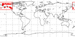
sample locations in study area
The Scripps Institution of Oceanography compiled descriptions of sediment samples in the Alaskan Outer Continental Shelf area, funded through the NOAA Outer Continental Shelf Environmental Assessment Program (OCSEAP), with previous funding from the International Decade of Ocean Exploration (IDOE) by the National Science Foundation, as part of the SIO world sediment data bank. Descriptions and basic grain size analyses of 688 core, dredge, and grab samples from the Alaskan outer continental shelf are included, along with station and reference information. These data are in ASCII form. Nodule description data are for approximately 100 cores, 585 grabs, and 3 box cores from the Northern Pacific offshore Alaska. Data include lithology, percent CaCO3, constituents by grain size, organic material/fossils, ages, other features, and minerals. Station and inventory information are included. Headers in the data provide format information necessary to read the files, codes are translated in the references noted below. Bibliographic references to the data are included at the end of the file. The grain size data were too general for inclusion in the NGDC digital grain size database with other OCSEAP grain size analyses. They are available for direct download from NCEI's web site.
  • Cite as: Frazer, Jane and Mary Fisk. 1976: Scripps Sediment Description File- OCSEAP Portion. First. NOAA National Centers for Environmental Information. Accessed [date].
  • ID not available.
gov.noaa.ngdc.mgg.geology:G02896
Download Data
Distribution Formats
  • ASCII
Ordering Instructions Contact NCEI for other distribution options and instructions.
Distributor NOAA National Centers for Environmental Information
ncei.info@noaa.gov
Dataset Point of Contact NOAA National Centers for Environmental Information
ncei.info@noaa.gov
Dataset Point of Contact Marine Geology Data Manager
NOAA National Centers for Environmental Information
geology.info@noaa.gov
Coverage Description North Pacific Ocean
Time Period 1976-10-04 to 1976-10-04
Spatial Reference System urn:ogc:def:crs:EPSG:4326
Spatial Bounding Box Coordinates
West:-176.045
East:172.075
South:50.041
North:73.55
Spatial Coverage Map
General Documentation
  • Metadata Landing Page
    Metadata record containing information about the database and links to download data and documentation
Associated Resources
Publication Dates
  • publication: 1976-10-04
  • revision: 1976-10-04
Edition First
Data Presentation Form Digital table - digital representation of facts or figures systematically displayed, especially in columns
Dataset Progress Status Complete - production of the data has been completed
Historical archive - data has been stored in an offline storage facility
Data Update Frequency Not planned - Completed data set, no additions planned.
Purpose environmental research
Use Limitations
  • Produced by the NOAA National Centers for Environmental Information. Not subject to copyright protection within the United States.
Dataset Citation
  • Cite as: Frazer, Jane and Mary Fisk. 1976: Scripps Sediment Description File- OCSEAP Portion. First. NOAA National Centers for Environmental Information. Accessed [date].
Cited Authors
  • Frazer, Jane
    Scripps Institution of Oceanography (SIO)
  • Mary Fisk
    Scripps Institution of Oceanography (SIO)
Publishers
  • NOAA National Centers for Environmental Information
Acknowledgments
  • Scripps Institution of Oceanography, funded by NOAA through the Outer Continental Shelf Environmental Assessment Program (OCSEAP) and the U.S. National Science Foundation through the International Decade of Ocean Exploration (IDOE)
Theme keywords Library of Congress Subject Headings
  • Scientific archives
  • Electronic records
  • Oceanography
  • Ocean bottom
  • Geology
  • Submarine geology
  • Marine sediments
SeaDataNet Common Vocabularies
  • Marine geology
USGS Science Topics
  • Sea-floor characteristics
Global Change Master Directory (GCMD) Science Keywords
  • Earth Science > Oceans > Marine Sediments
  • Earth Science > Paleoclimate > Ocean/Lake Records > Sediments
  • Earth Science > Oceans > Marine Sediments > Sediment Composition
  • Earth Science > Oceans > Marine Sediments > Sedimentary Textures
CIESIN Keyword Thesaurus
  • CIESIN > Environmental Protection > Environmental Monitoring
Data Center keywords Global Change Master Directory (GCMD) Data Center Keywords
  • DOC/NOAA/NESDIS/NCEI > National Centers for Environmental Information, NESDIS, NOAA, U.S. Department of Commerce
  • DOC/NOAA/NESDIS/NGDC > National Geophysical Data Center, NESDIS, NOAA, U.S. Department of Commerce
Platform keywords Global Change Master Directory (GCMD) Platform Keywords
  • In Situ Ocean-based Platforms > Ships
Instrument keywords Global Change Master Directory (GCMD) Instrument Keywords
  • In Situ/Laboratory Instruments > Corers > Coring Devices
  • In Situ/Laboratory Instruments > Samplers > Grabbers/Traps/Collectors > Grab Samplers
  • In Situ/Laboratory Instruments > Corers > Sediment Corers
Place keywords Global Change Master Directory (GCMD) Location Keywords
  • Ocean > Pacific Ocean > NORTH PACIFIC OCEAN
  • Vertical Location >Sea Floor
Project keywords Global Change Master Directory (GCMD) Project Keywords
  • IDOE > International Decade of Ocean Exploration
  • OCSEAP > Outer Continental Shelf Environmental Assessment Project
  • ICSU-WDS > International Council for Science - World Data System
NODC PROJECT NAMES THESAURUS
Use Constraints
  • Use liability: NOAA and NCEI cannot provide any warranty as to the accuracy, reliability, or completeness of furnished data. Users assume responsibility to determine the usability of these data. The user is responsible for the results of any application of this data for other than its intended purpose.
  • While every effort has been made to ensure that these data are accurate and reliable within the limits of the current state of the art, NOAA cannot assume liability for any damages caused by any errors or omissions in the data, nor as a result of the failure of the data to function on a particular system. NOAA makes no warranty, expressed or implied, nor does the fact of distribution constitute such a warranty.
Access Constraints
  • Distribution liability: NOAA and NCEI make no warranty, expressed or implied, regarding these data, nor does the fact of distribution constitute such a warranty. NOAA and NCEI cannot assume liability for any damages caused by any errors or omissions in these data. If appropriate, NCEI can only certify that the data it distributes are an authentic copy of the records that were accepted for inclusion in the NCEI archives.
  • Access to this dataset is unrestricted.
Other Constraints Cite as: Frazer, Jane and Mary Fisk. 1976: Scripps Sediment Description File- OCSEAP Portion. First. NOAA National Centers for Environmental Information. Accessed [date].
Fees
  • In most cases, electronic downloads of the data are free. However, fees may apply for custom orders, data certifications, copies of analog materials, and data distribution on physical media.
Lineage information for:dataset
Lineage Statement lineage prior to transfer to NCEI is unknown
Processing Environment Native Dataset Environment: ASCII text
Source Datasets
Lineage information for:repository
Processing Steps
  • 2015-04-22T00:00:00 -NOAA created the National Centers for Environmental Information (NCEI) by merging NOAA's National Climatic Data Center (NCDC), National Geophysical Data Center (NGDC), and National Oceanographic Data Center (NODC), including the National Coastal Data Development Center (NCDDC), per the Consolidated and Further Continuing Appropriations Act, 2015, Public Law 113-235. NCEI launched publicly on April 22, 2015.
Acquisition Information (collection)
Instrument
  • various
Platform
  • In Situ Ocean-based Platforms > SHIPS
Last Modified: 2020-04-21
For questions about the information on this page, please email:ncei.info@noaa.gov