NCEI Marine Geology Data Archive
 data locations
Marine Geologic data compilations and reports in the NCEI archive are from academic
and government sources around the world. Over ten terabytes of analyses, descriptions,
and images of sediment and rock from the ocean floor and lakebeds are available.
Examples of data available include sediment/rock composition, physical properties,
petrology/mineralogy, geochemistry, paleontology, paleomagnetism, x-rays, photographs,
and other imagery. All reports and data, regardless of format, are accessible via
the Marine Geology Digital Inventory and/or linked to the Index to Marine and Lacustrine
Geological Samples (IMLGS). Searches offer free, immediate download of digital data,
many images, and .PDF reports, and information on how to obtain full-resolution images
from the archive, and order CD-ROMs, microfilm, or oversize charts. Some larger data
sets, including the IMLGS, have their own web interfaces. The IMLGS provides searches
of sea floor and lakebed cores, grabs, dredges, and drill samples available from sample
repositories at partner institutions, with links to browse and download related information
from NCEI and other sources.
- Please cite DOIs for individual data sets. If no DOI is available, cite the data set originator, the date downloaded, and NOAA/NCEI as the source of the data.
- NCEI Metadata ID: gov.noaa.ngdc:Marine_Geology
gov.noaa.ngdc:Marine_Geology
| Search Data |
|
| Distribution Formats |
|
| Ordering Instructions | Contact NCEI for other distribution options and instructions. |
| Distributor | NOAA National Centers for Environmental Information ncei.info@noaa.gov |
| Dataset Point of Contact | NOAA National Centers for Environmental Information ncei.info@noaa.gov |
| Dataset Point of Contact | Marine Geology Data Manager NOAA National Centers for Environmental Information geology.info@noaa.gov |
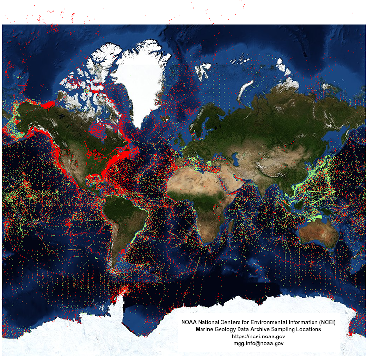
| Coverage Description | Global ocean floor |
| Time Period | 1930-01-01 to 2013-11-29 |
| Spatial Reference System | urn:ogc:def:crs:EPSG::4326 |
| Spatial Bounding Box Coordinates |
West:-180.0
East:180.0
South:-90.0
North:90.0
|
| Spatial Coverage Map | |
| General Documentation |
|
| Associated Resources |
|
| Publication Dates |
|
| Edition | First |
| Data Presentation Form | digital |
| Dataset Progress Status | Ongoing - data is continually being updated Historical archive - data has been stored in an offline storage facility |
| Data Update Frequency | Irregular - Additions as new data are received. |
| Supplemental Information |
Many data reports were received as paper copies, on 35-mm or 16-mm microfilm, or microfiche.
All paper reports have been scanned to PDF and some microfilm reports are also available
as PDF, however some reports are obtainable only offline in their original form.
|
| Purpose | Research in global change, benthic habitats, mineral resources, and environmental processes. |
| Use Limitations |
|
| Dataset Citation |
|
| Cited Authors |
|
| Originators |
|
| Publishers |
|
| Acknowledgments |
|
| Theme keywords | Library of Congress Subject Headings
|
| Data Center keywords | Global Change Master Directory (GCMD) Data Center Keywords
|
| Platform keywords | Global Change Master Directory (GCMD) Platform Keywords
|
| Instrument keywords | Global Change Master Directory (GCMD) Instrument Keywords
|
| Place keywords | Global Change Master Directory (GCMD) Location Keywords
|
| Project keywords | Global Change Master Directory (GCMD) Project Keywords
|
| Use Constraints |
|
| Access Constraints |
|
| Other Constraints | Please cite DOIs for individual data sets. If no DOI is available, cite the data set originator, the date downloaded, and NOAA/NCEI as the source of the data. |
| Fees |
|
| Lineage Statement | Lineage prior to transfer to NCEI is unknown. |
| Processing Environment | Native Dataset Environment: ASCII text |
| Source Datasets |
| Processing Steps |
|
| Instrument |
|
| Platform |
|
Last Modified: 2020-05-04
For questions about the information on this page, please email:ncei.info@noaa.gov