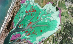
| Delaware Bay, Delaware Benthic Habitats 2010 Geoform |
 |
The Coastal Program of Delaware's Division of Soil and Water conservation (DNREC),
the University of Delaware, Partnership for the Delaware Estuary, and the New Jersey
Department of Environmental Protection have partnered and are carrying out a bottom
and sub-bottom imaging project to identify and map the benthic habitat and sub-bottom
sediments of Delaware Bay and River. This project was initiated to better understand
the distribution of bottom sediment types, habitat biodiversity, and most importantly,
human's impact on the bay bottom and its living resources. The project integrates
the use of three types of acoustical systems: Roxann Seabed classification system,
chirp sub-bottom profiling, and multi-beam bathymetric mapping. Verification of the
acoustic data with bottom and sub-bottom sediments is performed through the collection
of bra banc core samples and underwater video images. Original contact information:
Contact Org: NOAA Office for Coastal Management Phone: 843-740-1202 Email: coastal.info@noaa.gov |
|