| AIS Ship Traffic: Hawaii: 2008-2009: Binned: 1km |
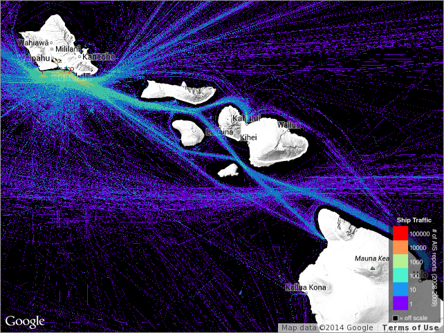 |
Ship traffic for the State of Hawaii, identifying the number of times a vessel occupied
each square kilometer during the period 2008-2009. The Automatic Identification System
(AIS) is an internationally-recognized shipboard broadcast system that communicates
information to shore-based stations and other AIS-equipped ships. The U.S. Coast Guard
(USCG) has developed rules applicable to both U.S. and foreign vessels that require
owners and operators of most commercial vessels to install and use AIS to increase
security and safety of maritime transportation. PacIOOS obtained AIS data from the
USCG Nationwide AIS (NAIS) project. While specific times for ship locations were redacted,
the data represent a cumulation over the two-year period 2008-2009 from which ship
frequency was computed at 1-km resolution. |
|