 |
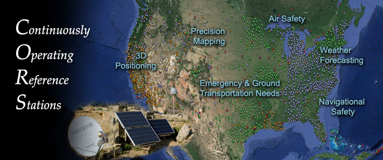
The National Geodetic Survey's (NGS) NOAA Continuously Operating Reference Stations
(CORS) Network (NCN) provides Global Navigation Satellite System (GNSS) data consisting
of carrier phase and code range measurements in support of three dimensional positioning,
meteorology, space weather, and geophysical applications throughout the United States,
its territories, and a few foreign countries. Surveyors, GIS users, engineers, scientists,
and the public at large that collect GPS data can use CORS data to improve the precision
of their positions. CORS enhanced post-processed coordinates approach a few centimeters
relative to the National Spatial Reference System (NSRS), both horizontally and vertically.
The CORS network is a multi-purpose cooperative endeavor involving government, academic,
and private organizations. The sites are independently owned and operated. Each agency
shares their data with NGS, and NGS in turn analyzes and distributes the data free
of charge. |