Archive of Core and Site/Hole Data and Photographs from the Deep Sea Drilling Project (DSDP)
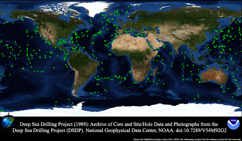 DSDP drill sites
The Deep Sea Drilling Project (DSDP) operated the D/V GLOMAR CHALLENGER from 1968-1983,
drilling 1,112 holes at 624 sites worldwide. The DSDP was funded by the US National
Science Foundation and several foreign countries through the Joint Oceanographic Institutions
for Deep Earth Sampling (JOIDES), and was operated by the Scripps Institution of Oceanography.
The DSDP data management group at SIO compiled a full suite of computerized marine
geological and geophysical data files before they were disbanded in 1987, at which
time the data files were transferred to NGDC and to the Ocean Drilling Program at
Texas A&M University for distribution.In 1989, with support from, and in cooperation
with, the Joint Oceanographic Institutions, Inc., U.S. Science Support Program, NGDC
produced two compact discs (CDROM) containing all computerized DSDP data. In 2000,
all but the logging and geophysical data were re-released as 1 CD-ROM with an HTML
interface. Data are available for free online download. In 2007, the Integrated Ocean
Drilling Program (IODP) transferred digital images of all core photographs and closeup
core photographs in their collection to NGDC for archive. Due to their volume, these
data are not available online, but are archived and available on request. The photo
collections consists of 17,635 high-resolution TIFF files, volume 553.34 gigabytes.
- Cite as: Deep Sea Drilling Project.1989: Archive of Core and Site/Hole Data and Photographs from the Deep Sea Drilling Project (DSDP). Third. NOAA National Centers for Environmental Information. https://doi.org/10.7289/V54M92G2. Accessed [date].
- doi:10.7289/V54M92G2
- NCEI Metadata ID: gov.noaa.ngdc.mgg.geology:G00993
gov.noaa.ngdc.mgg.geology:G00993
| Search Data |
|
| Download Data |
|
| Distribution Formats |
|
| Ordering Instructions | Contact NCEI for other distribution options and instructions. |
| Distributor | NOAA National Centers for Environmental Information ncei.info@noaa.gov |
| Dataset Point of Contact | NOAA National Centers for Environmental Information ncei.info@noaa.gov |
| Dataset Point of Contact | Marine Geology Data Manager NOAA National Centers for Environmental Information geology.info@noaa.gov |
| Coverage Description | Global sea floor - sparse locations |
| Time Period | 1968-01-01 to 2000-12-31 |
| Spatial Reference System | urn:ogc:def:crs:EPSG:4326 |
| Spatial Bounding Box Coordinates |
West:-178.5
East:179.7380
South:-77.4420
North:76.15000
|
| Spatial Coverage Map | |
| General Documentation |
|
| Associated Resources |
|
| Publication Dates |
|
| Edition | Third |
| Data Presentation Form | Digital table - digital representation of facts or figures systematically displayed,
especially in columns Digital image Digital document - digital representation of a primarily textual item (can contain illustrations also) |
| Dataset Progress Status | Complete - production of the data has been completed Historical archive - data has been stored in an offline storage facility |
| Data Update Frequency | Not planned - Completed data set, no additions planned. |
| Supplemental Information |
The original, 1989 DSDP CDROM set included two discs and access software developed
by NGDC for DOS and Macintosh platforms. Disc I contained sediment and hard rock descriptive
and analytical data, documentation files, and several summary and reference files.
Disc II contained downhole logging in the Schlumberger LIS format, and underway geophysical
data (bathymetry, magnetics, and navigation) in the MGD77 format - the borehole and
geophysical data are not included in the current metadata record/data set. Not all
data types are included for all legs. Data files on the discs include the following:
Age profile, carbon-carbonate, core depth recovery, density-porosity, gamma ray attenuation
porosity evaluator (GRAPE), hard rock major and minor element geochemistry, thin section
and visual descriptions of hard rock samples, interstitial water chemistry paleomagnetism
of sediment and hard rock samples, paleonotology (including 22 fossil groups), smear
slide descriptions, sonic velocity, vane shear, visual core descriptions, and x-ray
mineralogy. Core images were scanned from paper photographs/negatives by staff of
the Ocean Drilling Program. Additional images of laboratory forms, were scanned from
microfilm under an NGDC CDMP project. All images are available offline only due to
volume. Note: on Feb 22, 2006 latitude/longitude information was updated for LEG 001
Hole 2 to correct an error that was present since the files were first transferred
to NGDC. ODP personnel certified the correction.
|
| Purpose | Scientific Research |
| Use Limitations |
|
| Dataset Citation |
|
| Cited Authors |
|
| Originators |
|
| Publishers |
|
| Acknowledgments |
|
| Theme keywords | Library of Congress Subject Headings
|
| Data Center keywords | Global Change Master Directory (GCMD) Data Center Keywords
|
| Platform keywords | Global Change Master Directory (GCMD) Platform Keywords
|
| Instrument keywords | Global Change Master Directory (GCMD) Instrument Keywords
|
| Place keywords | Global Change Master Directory (GCMD) Location Keywords
|
| Project keywords | Global Change Master Directory (GCMD) Project Keywords
|
| Use Constraints |
|
| Access Constraints |
|
| Other Constraints | Cite as: Deep Sea Drilling Project.1989: Archive of Core and Site/Hole Data and Photographs from the Deep Sea Drilling Project (DSDP). Third. NOAA National Centers for Environmental Information. https://doi.org/10.7289/V54M92G2. Accessed [date]. |
| Fees |
|
| Lineage Statement | Prior to transmission to NGDC, the core data were maintained in a pre-relational database management system written in Algol on a Burroughs computer. Data were written off to 9-track magnetic tape for transfer to both NGDC and the successor Ocean Drilling Program (ODP) at Texas A and M University. The Burroughs computer was then decommissioned and no further work was possible to change or correct the data that came from it. Peter Woodbury did do some post-database correction on the SCREEN database. Digital images were scanned by staff of the Ocean Drilling Program (ODP) at Texas A and M University, from core photographs taken by DSDP staff, and some later photographs taken by ODP staff. |
| Processing Environment | Native Dataset Environment: ASCII text |
| Source Datasets |
| Processing Steps |
|
| Instrument |
|
| Platform |
|
Last Modified: 2020-04-21
For questions about the information on this page, please email:ncei.info@noaa.gov